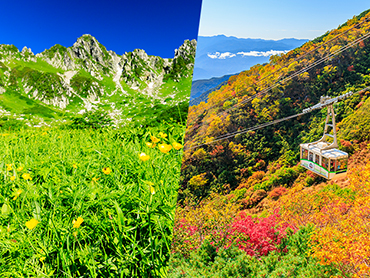
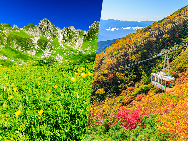
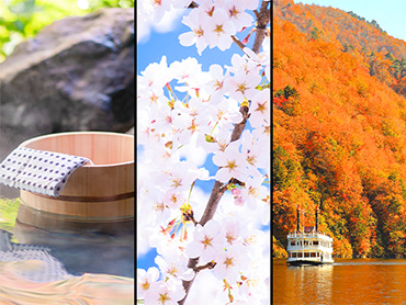
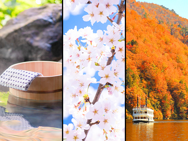
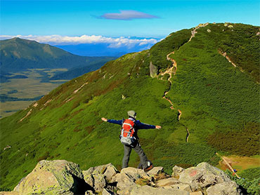
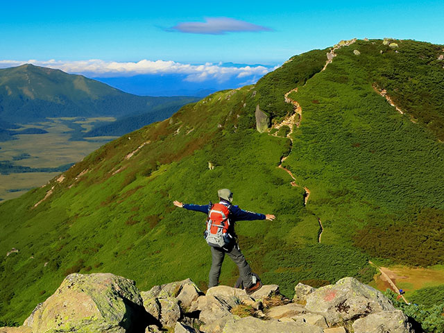
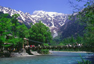
[Kamikochi highlights, alpine plants, clothes and belongings] Kamikochi Tour/Travel
![[Kamikochi highlights, alpine plants, clothes and belongings] Kamikochi Tour/Travel](https://data.wovn.io/ImageValue/production/6616682fb8881a0087233fa2/en/b8a34df3be169c19984ebbc6aba924eb/sp_special_japan_kamikouchi_images_headline_h_main_pc_01_en.jpg)
![[Kamikochi highlights, alpine plants, clothes and belongings] Kamikochi Tour/Travel](https://data.wovn.io/ImageValue/production/6616682fb8881a0087233fa2/en/f3860e5bd26626853eb2e21adf4709b6/sp_special_japan_kamikouchi_images_headline_h_main_sp_01_en.jpg)
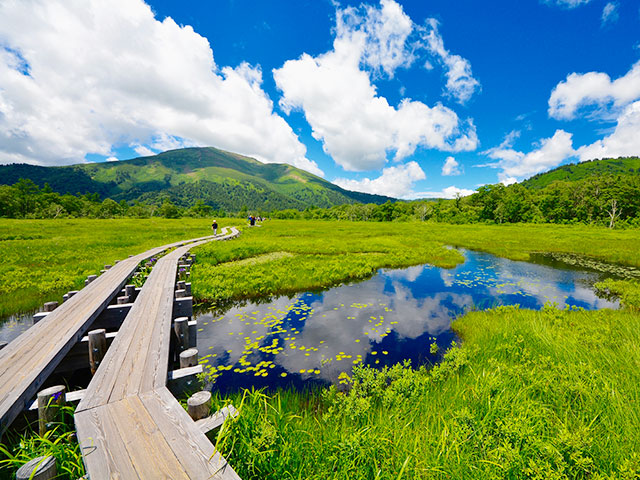
Kamikochi For tours and travel, visit Club Tourism! Our tour guides and staff will support you. Since there are restrictions on private cars, we recommend that you take a tour (trip) by bus or train to Kamikochi, a representative scenic spot in Shinshu located at an altitude of 1,500 meters. Searching and booking tours is easy.
What to see in Kamikochi
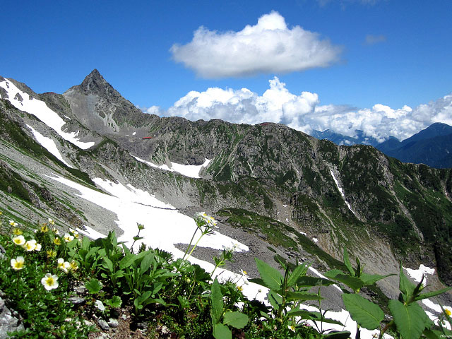
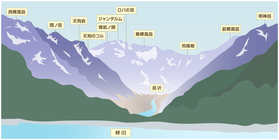
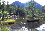
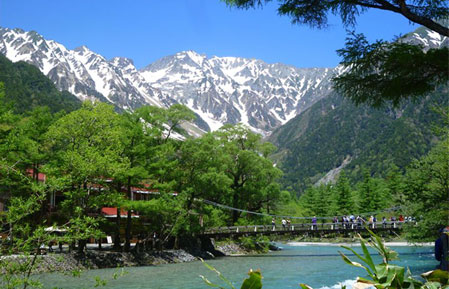
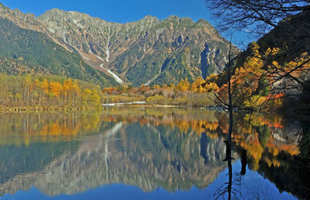
[Breathtaking views!!] Introducing the mountains of Kamikochi
What to see in Kamikochi
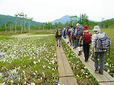
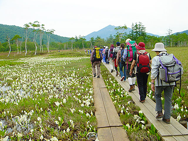
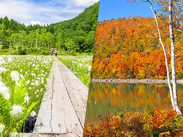
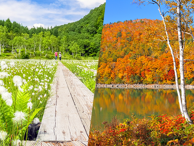
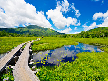
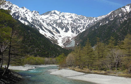
Kamikochi is characterized by its easy-to-walk paths. Although there are some ups and downs, the path is mostly flat, making it perfect for a leisurely stroll. It takes about an hour to reach Taisho Pond after getting off the bus at the bus terminal. If you have three hours from Taisho Pond, you can extend your journey to Myojin Pond, stopping off at places like Tashiro Pond along the way. Why not spend a soothing moment walking while enjoying a close-up view of the majestic Hotaka Mountains, viewing the delicate wildflowers, and listening to the chirps of wild birds?
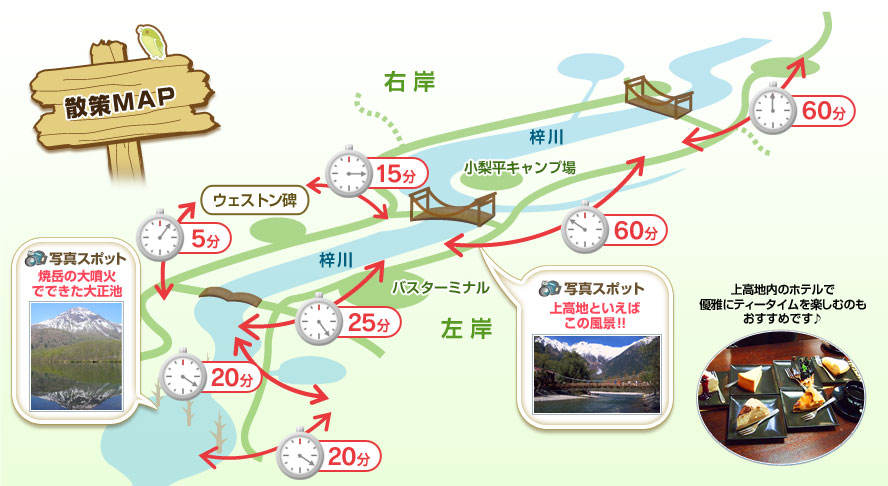
Recommended walking courses
[1 hour course]
● Bus terminal → Kappa Bridge → Right bank of the Azusa River → Weston Monument → Tashiro Bridge → Left bank of the Azusa River → Bus terminal
[2 hour course]
● Bus terminal → Kappa Bridge → Left bank of the Azusa River → Myojin Pond → Right bank of the Azusa River → Kappa Bridge → Bus terminal
● Bus terminal → Tashiro Bridge → Nature trail → Taisho Pond (round trip)
[4-hour course]
● Bus terminal → Kappa Bridge → Myojin Junction → Tokusawa → Shinmura Bridge → Azusa River right bank forest road → Myojin Pond → Kappa Bridge
[Special walking course guide: 4-hour course]
● Bus terminal → Kappa Bridge → Nature School → Myojin Bridge → Myojin Pond → Kappa Bridge → Weston Monument → Tashiro Bridge → Nature Study Trail → Round trip to Taisho Pond → Bus terminal
[5 hour course]
● Bus terminal → Kappa Bridge → Myojin → Tokusawa → Shinmura Bridge → Azusa River right bank forest road → Myojin Pond → Kappa Bridge → Weston Monument → Tashiro Bridge → Bus terminal
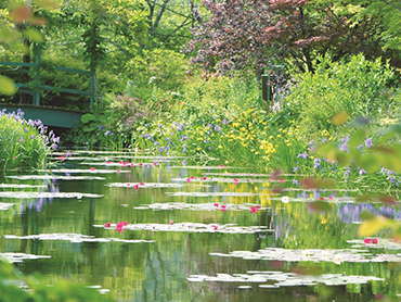
明神池(みょうじんいけ)
<写真提供>
信州・長野県観光協会
明神池はひょうたん型で一の池と二の池があります。池は、池畔にある穂高神社奥宮の神域となっており、目の前の明神岳からの伏流水で透き通っています。
※おひとり様300円の拝観料がかかります
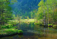
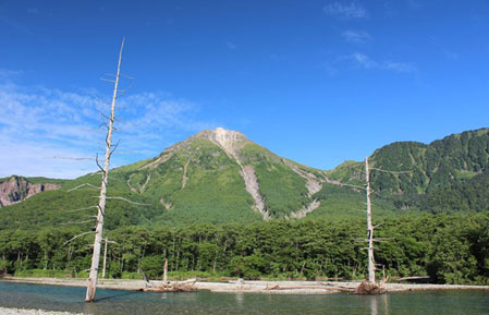
徳沢(とくさわ)
奥上高地と呼ばれ、雪を抱いた険しい峰がアルプス的な風景を作り出す絶景地です。昭和初期までは牧場が開かれていたため、周辺は開けた草原となっています。
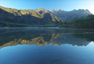
大正池
<写真提供>
信州・長野県観光協会
大正池は、大正4年の焼岳大爆発によってせきとめられてできた池。穂高連峰や焼岳、枯れ木が湖面に映る景観は、上高地を象徴する風景です。
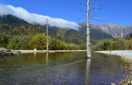
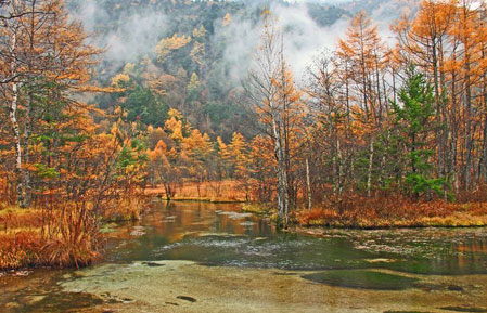
田代池(たしろいけ)
原生林の中に広がる湿原地帯に、ぽっかりと浮かぶのが、田代池です。澄み切った水面にはイワナが見えることもあります
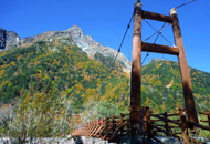
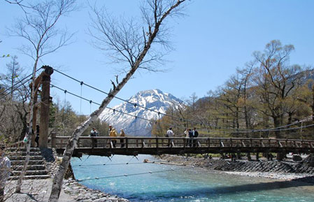
河童橋(かっぱばし)
清冽な川にかかる河童橋は、上高地のシンボル。大正時代に造られた橋で、数回の架け替えを経て現在は五代目。大自然の中、果敢にかけられた吊り橋は、堂々たる山岳風景の中に溶け込んでいます。
田代橋(たしろばし)
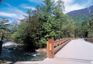
平成10年11月に竣工した両橋は、長野県産のカラマツとヒノキだけが使われ景観に配慮してデザインされた木橋です。
田代橋 橋長:22メートル 幅員:5.5メートル
Myojin Bridge
明神には松本から上高地への昔のメインルートだった徳本峠の入り口があり、このため上高地でもっとも早く開けた一帯として知られています。
古来利用され、今こそひっそりとした峠道ですが、かつてはW.ウェストンらの登山家、大正・昭和にかけては芥川龍之介、高村光太郎などの文人墨客が歩き頂上の明神にたどり着きました。
正面に明神岳岩峰群がそそり立ち、河童橋から眺めた印象と全く異なります。
厳しさを際立たせるその姿に、穂高岳の尊称としての明神岳を実感することができます。
Customer Photo Gallery
愛知県の出口武様の作品
岡山県の日笠豊一様の作品
神奈川県の矢野一馬様の作品
静岡県の川合繁男様の作品
千葉県の鎌田康夫様の作品
千葉県の久山博文様の作品
東京都のペンネーム:スカイツリー砂糖さんの作品
東京都の斉藤佳子様の作品
東京都の相馬昭夫様の作品
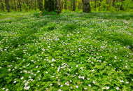
高山植物カレンダー
上高地には高山植物など数多くの花が咲きます。それぞれの見頃については、こちらをご覧ください。
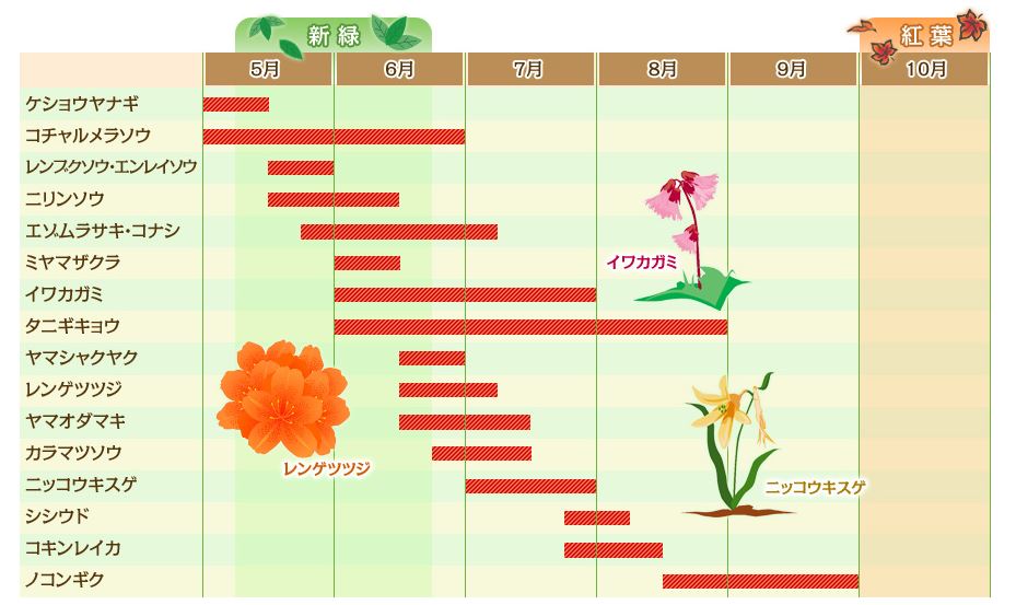
※開花や紅葉時期は目安です。気象状況により前後する場合があります。
花咲く高原の自然探勝
4月の半ばになるとウグイスが本格的な春の訪れを告げに戻ってきます。ウグイスに負けまいと美しいルリ色の羽を広げたオオルリがさえずりながら梢を渡り、芽吹きはじめた木立に色彩を添えます。5月~6月はニリンソウやエゾムラサキなどの高山植物もあちこちで咲き始めます。徳沢のニリンソウの群生は、ニリンソウがハルニレの木のあいだにまるで雪のように咲き誇り、生き物のあふれる生命力を感じられます。エゾムラサキは小さな花が集まって咲きますが、青や紫のほか、白やピンクがかかっていて、とてもカラフルです。
短い初夏から夏に咲く花々の競演は、散策の一番の楽しみです。
この時期の上高地でみられる花(花期:5月~6月)
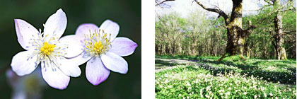
かれんな白い花をつけるニリンソウ/遊歩道脇に群生するニリンソウ(イメージ)
高山植物を見つけてみよう!
高山植物を見つけ7月~8月は、高山植物の花が咲きほこります。
「ノアザミ」「ヤチトリカブト」「ニッコウキスゲ」など、多種多様!
上高地の売店には「花図鑑」が売っています。
お花が好きな方は、ひとつひとつ名前を調べながら歩くと、あらたな発見があり、いつもの何倍も上高地を満喫できます。てみよう!
この時期の上高地でみられる花(花期:7月~8月)
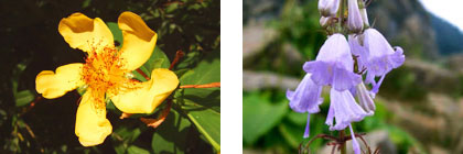
トモエソウ/ハクサンシャジン(イメージ)
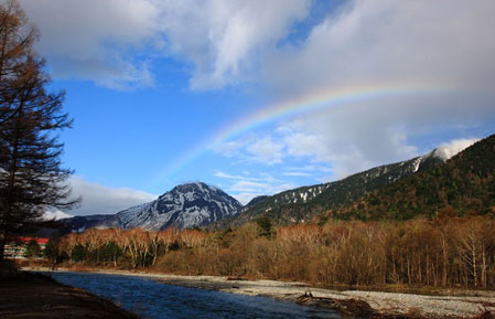
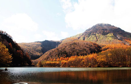
北アルプス連峰の冠雪も・・・カラマツ林が黄金に染まる秋!
上高地の紅葉は「黄葉」です。
カラマツの葉が金色に色づいてくると、上高地は一面黄金色に輝きます。
すると、競うようにシラカバは黄色に、ナナカマドは朱色に。梓川沿いに敷かれた遊歩道を歩きながら、大正池~河童橋とのんびり散策を楽しみましょう。
上高地で最も有名なスポット、梓川にかかる「河童橋」から眺める秋の穂高連峰には、降雪が確認できることもある季節です。
穂高連峰山頂に冠雪すると、「雪の白」「カラマツの黄金色」「針葉樹の緑」という、見事な三段紅葉を眺めることができます。
一度は見ていただきたい、絶景の山岳紅葉です。
この時期の上高地でみられる黄葉
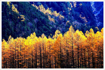
黄葉のカラマツ(イメージ)
What to wear and what to bring
Kamikochi is located at an altitude of 1,500 meters, so the temperature can be 5 to 10 degrees lower than in Matsumoto city at the base (altitude about 600 meters).
In early spring and early autumn in particular, minimum temperatures can drop below freezing, and snowfall can occur up until around Golden Week and from around mid-Oct. onwards, so you will need to prepare for the cold.
Even in summer, the minimum temperature can drop below 10 degrees, so be sure to bring an extra layer of clothing.
Also, because it is a mountainous region, the weather can change quickly, so we recommend that you bring rain gear when exploring.
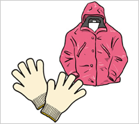
Early spring/late autumn (April to mid-May. /October to Nov.)
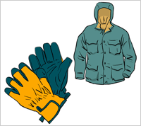
この時期は雪が降ることもあります。平地の冬の服装でお越しください。フリースやダウンジャケットの上から、風を通さない上着を着るのがおすすめです。
【服装例】
フリース又はダウンジャケット、ウインドブレーカー、厚手のズボン、毛糸などの手袋・帽子、暖かめの靴
【気温】
4月 7.4℃/10月 12.7℃
Spring/Autumn (mid-May. to late Jun., mid-Aug. to late Sep.)
朝晩は霜が降りることもありますので、お泊まりの方は上着を忘れずにお持ちください。また春は日差しが非常に強くなりますので、日焼け対策をしっかりしてお越しください。
【服装例】
薄手のフリース、ウインドブレーカー、歩きやすい長ズボン、つばのある帽子、薄手の手袋、スニーカー等の歩きやすい靴
【気温】
5月 14.3℃/6月 17.1℃/9月 17.3℃
Summer (early Jul. to late Aug.)

晴れた日中はTシャツでも大丈夫ですが、朝晩や天気の悪い日は気温が下がりますので、薄手の上着をご用意ください。また、虫よけスプレーなどがあると快適です。
【服装例】
長袖のシャツ、ウインドブレーカー、歩きやすい長ズボン、キャップ、スニーカー等の歩きやすい靴
【気温】
7月 21.2℃/8月 21.4℃
Wet day

上下が分かれるタイプのカッパが便利です。キャップがあると、フードをかぶっても視界がそれほど悪くならず快適に歩けます。
カッパと折り畳み傘の併用をお勧めします。
【服装例】
トレッキングシューズや長靴など、防水できる靴があると快適です。スニーカーの場合は防水スプレーなどをご利用ください。